Precise Data
Accurate Site Data for Every Project
Our expert Survey services ensure your project starts with reliable, precise measurements.
Engineering Survey and Drawing
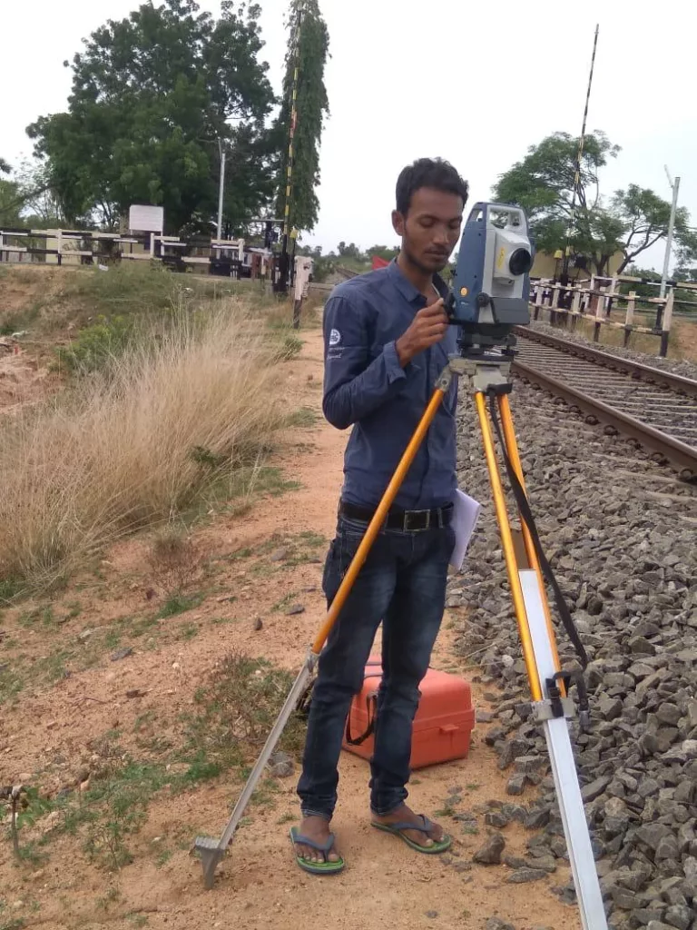
- Topographical Survey with DGPS, GPS & modern Total Stations
- Levelling by Digital Level & Auto Level instruments.
- Cadastral and Engineering Survey.
- Hydrographic Survey through Total Station, Current meter, Echo-sounder etc.
- Profiling, Contouring, Levelling, Curve setting, etc.
- Route alignment for roads, bridges, pipelines, power lines etc.
- As built survey for developed city regions.
- Quantity survey after construction.
Engineering Drawings
- Creating Engineering drawings, Topographical Maps with the help of advanced softwares like AutoCAD 2012 , AutoCAD Civil 3D,Auto Plotter etc.
- Producing profile of existing landforms with help of softwares like MX-Road, In-Roads, PLS CADD.
- Digitization of old revenue maps and cadastral maps.
- Calculation of cut-fill volumes.
- Preparation of Detailed survey Report.
- Preparation of Feasibility Report.
- Digital Terrain Modeling of the topographical maps.
Our Survey Process
Our Process, Made Simple
Our comprehensive survey methodology is designed for efficiency and precision, from initial consultation to final data delivery. We use calibrated instruments and certified surveyors to ensure every measurement contributes to the safety and success of your project, maintaining international standards.
1. Define & Assess
We thoroughly define the scope, select the optimal surveying techniques (e.g., GPS, Total Station), and review the site's historical context.
2. Field Execution
Our team mobilizes to capture precise field data, establishes control points, and performs all measurements efficiently and safely on-site.
3. Process & Deliver
The raw data is processed and drafted into accurate maps (e.g., CAD, GIS), delivering the final detailed topographical or engineering reports.